Last Day in the Smokies: the Walker Sisters’ Place

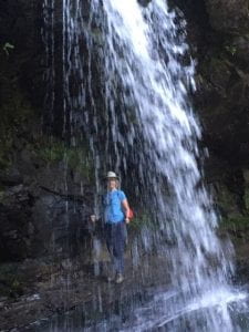
The Walker Sisters’ Place was the fourth of “6 Short Hikes” recommended on a blog by Vicky Reddish on the Great Smoky Mountains National Park Website. Before Friday we had taken the Laurel Falls Trail, the Clingman Dome Trail, and the Grotto Falls Trails, all scenic and within a 2-3 mile roundtrip.

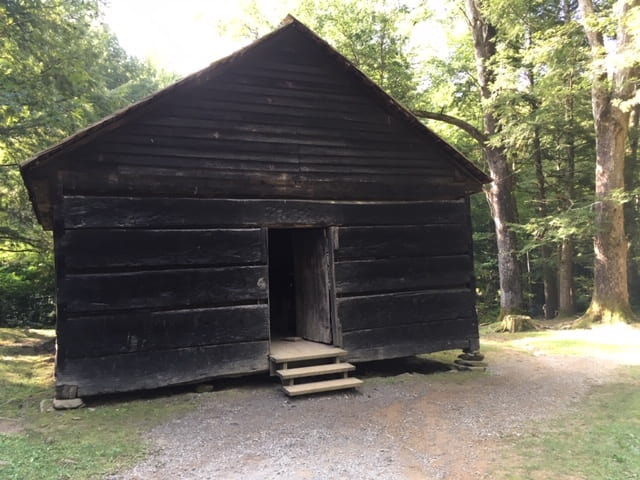
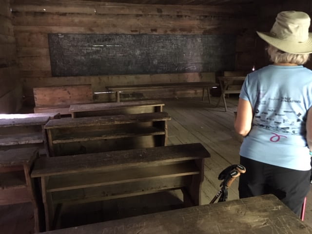
The Walker Sisters Place hike offered a creek alongside; a school house and cemetery; and a family tradition of almost a hundred years.  The Little Brier Gap Trail was narrow and criss-crossed with protruding roots, arriving at a schoolhouse at least a mile from the Park picnic area and a mile further to the Walker Sisters Place.

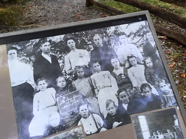
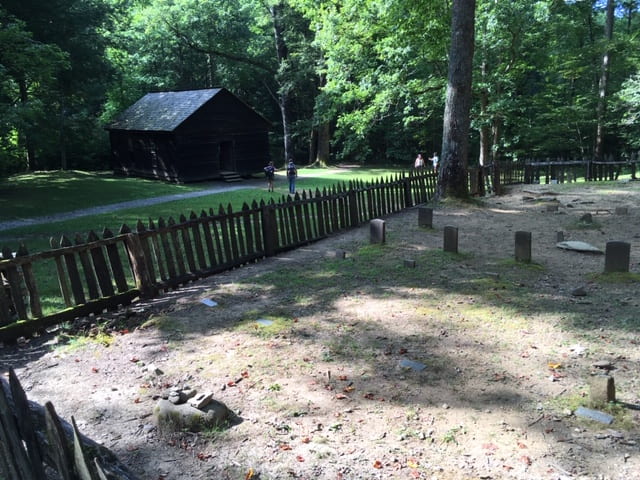
Below the interior and exterior of the school house is pictured, along with a longer shot from the cemetery  and a class picture of 1908.  The cemetery features a number of Walkers.  John and Margaret Walker had eleven children, four boys who made their fortune somewhere else and seven daughters, of which only one married.

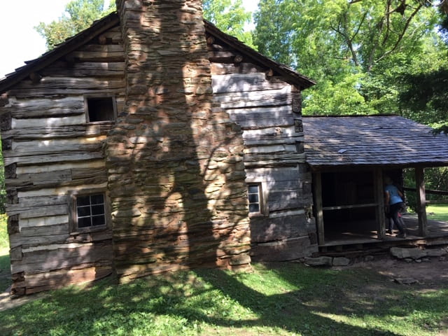
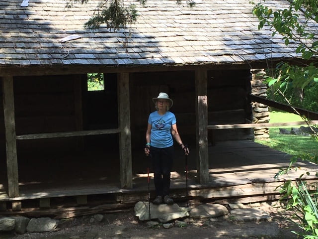
The other six remained in the home until the 1960’s. Nancy passed away in the 1930’s and the other sisters stayed while the National Park was built around them. The Park land was acquired in the 1930’s, and the sisters benefited at first. They sold souvenirs and told stories that made them a Park attraction. In their older years, the attention became exhausting, and they asked for privacy. When the last sister died in the 1960’s, the land was deeded to the National Park service. Two views of the house are displayed below. You can climb a ladder to the second floor, but there’s nothing but a bare floor and a single window to see.

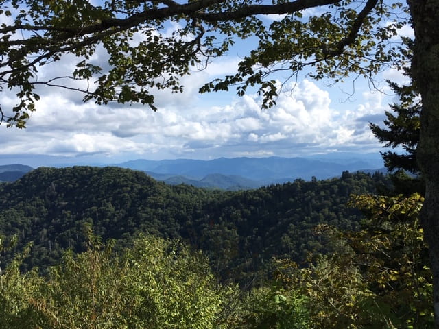
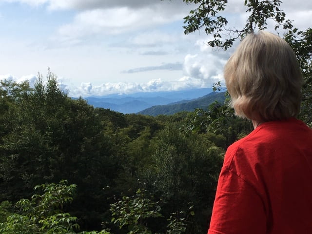
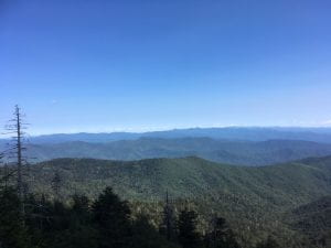
Plenty more to hike and see on a return visit to the Great Smoky Mountains National Park. There’ s Rainbow Falls, the Alum Cave Bluffs, the Hen Wallow Falls and the Blue Ridge Parkway. Everywhere you drive there is a mountain vista and a turn-off to park and take it in.  It leaves you with the sense of awe you know all Creation deserves. Here you can’t miss it.

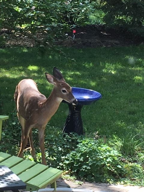
Several days after returning to Chesterfield we got another taste of that quiet awe, when a fawn came to drink at our bird bath, and then feasted on our flower bed. Most of the flowers were past, but they left enough residue to appeal to a deer. The fawn lingered at least fifteen minutes, reassuring us that our home was her home as well.  It still shoots me full of wonder to get that close to the wild.

The Smokies Day Five: New Found Gap and Cherokee

I look at this photo of New Found Gap taken with my cell phone and think: This is like viewing the splendor of the Smokies through a cardboard tube.  It just doesn’t capture the breath-taking beauty of the mountain range.  The Cherokees called the mountains “blue, like smoke” which gives a sense of their ethereal majesty.

When you look from an observation pullout on New Found Gap, you see layer after layer of upward graceful curves in the distance, and you are reminded of the “Misty Mountains” projected on the screen for Lord of the Rings.  They are a wonder. But I cannot transcribe the glory of traveling through the heart of the Great Smoky Mountains Park , a beautiful morning’s drive on a clear day.

Admittedly the spare tourist refuge of Cherokee, NC is an anti-climax after this. With a casino and dozens of Indian craft and souvenir shops, Cherokee can be a disappointment.  We enjoyed the buffet at Granny’s Kitchen, but it was standard Thanksgiving fare. No venison in sight.

The Cherokee Museum is more instructive and traces the tribal history from the “archaic” and “mastodon” periods to the present.  You can appreciate that a civilization existed in the Smoky Mountains and valleys before the white man shoved it into Arkansas and Oklahoma.

“The Museum of the Cherokee Indian is an interpretive site on the Trail of Tears National Historic Trail. Exhibits tell the story of the Trail of Tears through artifacts, artwork, audio narration, and life-sized figures.”

“Experience 13,000 years of Cherokee history, from the time when mastodons roamed the southern Appalachians to the present day.  This story is told through computer generated animation and special effects, life-sized figures, artwork, and priceless artifacts.”

We are learning how the Native peoples of the United States were terrorized and removed by the intruding White people. Our American history textbooks did not give an objective view of the Cherokees and their battle to save their land. Here is commentary from James W. Loewen, author of Lies My Teacher Told Me:

All recent textbooks tell how Andrew Jackson and John Marshall waged a titanic struggle over Georgia’s attempt to subjugate the Cherokees. Chief Justice Marshall found for the Cherokees, whereupon President Jackson ignored the Court, reputedly with the words,        “ John Marshall has made his decision; now let him enforce it!” But no textbook brings any suspense to the issue as one of the dominant questions throughout our first century as a nation. None tells how several Christian denominations–Quakers, Shakers, Moravians, some Presbyterians– and a faction of the Whig Party mobilized public opinion on behalf of fair play for the Native Americans. By ignoring the Whigs, textbooks make the Cherokee removal seem inevitable, another example of unacculturated aborigines helpless in the way of progress. (p. 132)

Early in the conflict with Georgia, some of the Cherokees retreated into the Smokies and hid from the troops attempting to herd them west. Many later remained in North Carolina and became known as the “Eastern Cherokees,” whereas those who were pushed into Arkansas and Oklahoma were known as the “Western Cherokees.”

On the trip north back through the Park, the traffic stopped for three elk casually crossing the road. One female elk paused on the median for a snack, and she is the only one who stood still long enough to photograph.

It was one of those extraordinary days when photographs did not capture the joy and depth of the occasion. You know, you really had to be there.


Smokies Day Four: Cades Cove

Cades Cove is a flattened valley fenced in by the majestic Smokies.  A “cove” in the mountains is quite dry compared with the protected inlets of the coastal United States, but it is just as serene and surrounded by cinematic beauty.  Unique to Cades Cove are the Wednesdays set aside for hikers and bikers, when no cars are permitted to crowd the one-way paved circular trail. So Wednesday was set aside for this eleven-mile trip on rented bikes.


Image may contain: mountain, sky, cloud, outdoor and nature
Even arriving at 8:25 a.m. we had to wait ninety minutes for the first available bike rentals at Cades Cove.  All 150 bikes were rented, some for an hour, some for the day. We still captured the morning breeze and cloudless sky for the first half of the journey, which  featured the some older homes and three churches.  The trail descended 100 feet from the initial 1880 foot elevation, but you hardly noticed until you had to get back those 100 feet on the second half of the loop.


The Cades Cove Primitive Baptist Church looked like the traditional white New England church with two entrances, one for the men and one for the women.  “Primitive” would describe the sanctuary, with straight-backed pews, holding 10-12 worshippers each. The story has it that the church divided after twelve years over the issue of “missions.”


Those who supported missions moved out and founded the Caves Cove Missionary Baptist Church down the road.  The Missionary Baptists constructed more contemporary pews inside and consolidated the two entrances into one. Between the two Baptist churches a Methodist Church was founded to maintain a social distance between denominations.

At the Missionary Baptist Church a group of five women sat in the back, while we settled up front in the choir pews. They broke into a few verses of “Amazing Grace,” and we joined their song. No one seemed to need a hymnal for at least three verses. They turned out to be Methodists, who cheerfully sang in all the churches on the route, regardless of denomination.

As we reached the half-way point of the trail, the mountains loomed up and humbled us along the east side of the road. Travelers stopped at small parking areas on the side to admire the view. The sun was heating up, and the breeze fading. The road began to drop more sharply. We had been warned to walk our bikes on one extended winding drop, so we did not speed out of control.

At length we reached the Visitors’ Center with its Grist Mill,  cantilevered barn, farmhouse and other outbuildings.  The Grist Mill was in near full operation from the deflected stream directed down to a Mill Race (see wooden channel below) to the turning mill wheel attached to a once-active mill for grinding the grain. The model stopped functioning at the wheel, but we got  the idea. There were some used grist stones discarded along the mill race.


The last half of the Cades Cove loop was more up and down, with the ups long and knee-crushing.  Too much of my up biking was walking and puffing.  We kept passing people who then passed us, but we sprinted at the end to arrive around 3:30 before the rain hit.

Puffing aside, this was our best day in the open, viewing a little nineteenth century Americana.  We biked eleven up-and-down miles and walked a bit more to reach our car.  11,000 steps, counting pedal pushing.

Smoky Mountain Odyssey: Days 1-3

If you heard that Smoky Mountain National Park is the most visited National Park– believe it! There are good reasons for the visitor swarm: the amazing mountain views, the well-maintained, well-marked  hiking trails, the foliage and wildflowers, the unspoiled beauty of the place.  We were blessed with September temperatures between 60 and 85 with not too much humidity.

The early morning (7-9:30 a.m.) is the best time to hike, because after 9:30 the processions begin, and suddenly you are sharing the waterfall views with thirty of your closest friends. Not that anyone was obnoxious or noisy, but they made you aware that you were at an attraction.

Below you can see what we saw on our first three days of the visit: Clingman’s Dome and Grotto Falls. Of course it is impossible to capture the mountain vistas with a cell phone camera, but you can see enough to spark your imagination– the layered mountain ranges the Cherokee called “blue, like smoke” hence our terminology “the Smokies.”

Clingman’s Dome (see flying saucer viewing deck)  is the top of the park at around 6600 feet, and we ascended on a very clear Sunday of Labor Day Weekend.  The walk up to the Dome is paved, but steep. With the many foreign visitors who accompanied us, you had the feeling of the last leg of a pilgrimage. We did not hear a lot of English spoken on that ascent. We had to  stop a few times to catch our breaths, but the view at the top was worth it. The photos do no justice to it.


Even after the crowds disbanded after Labor Day, the park was well-travelled, and we planned hikes for early morning on Monday and Tuesday. Below you see Victoria at Grotto Falls, the only waterfall in the park you can walk under.  We reached it with a mile and half walk up the ridge, and the gathering was less than ten until 9 a.m. When we began the return trip, the pilgrims began to flood the path.  The Grotto was a highlight of our visit.

We stayed outside of Gatlinburg in the Laurel Point Resort, an exchange property for RCI. The town is a tourist trap, and, for me, a distraction from the spectacular views of the park. We spent about an hour there ($10 parking) to buy some groceries on a Sunday evening, but found no place we wanted to eat. I might have lost my chance to eat local trout, but we did not want to buck the lines.

The two-bedroom condo has been comfortable. We have spread our maps, brochures, and books all over like a base camp. Victoria made some bean soup that has great staying power, and we are well provisioned.  Glory be!