Taos: A Tale of Two Other Cities

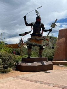
Taos is almost a tale of two cities by itself: the artist colony and the pueblo. We visited both on Friday.  One surprising discovery at the Museum of Spanish Colonial Art was the bumper sticker “Make America Gracious Again.” I decided to make a statement by juxtaposing it between the fierce Pueblo warrior and the praying Pueblo farmer.  The farmer was considered a liability as a day laborer, because he preferred praying to tilling the soil.  Juxtaposing him with “Make America Gracious Again” gives him a certain dignity, because the words might be considered a prayer on behalf of the growing nation.

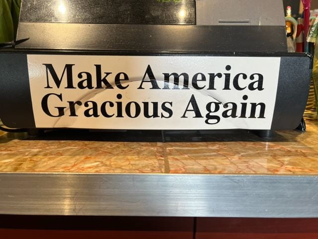
Found at Register of Museum of Spanish Colonial Art


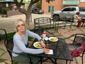
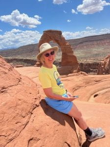
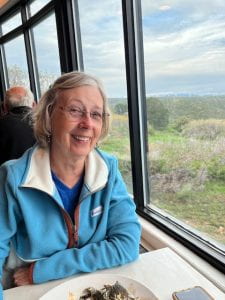
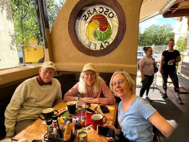
In the city of Taos, one of my best lunches came from “Bomb Street,” an outdoor taco stand with a commitment to spicy. Victoria is pictured below enjoying a selection from their small menu. The taco sauce burned sweetly!

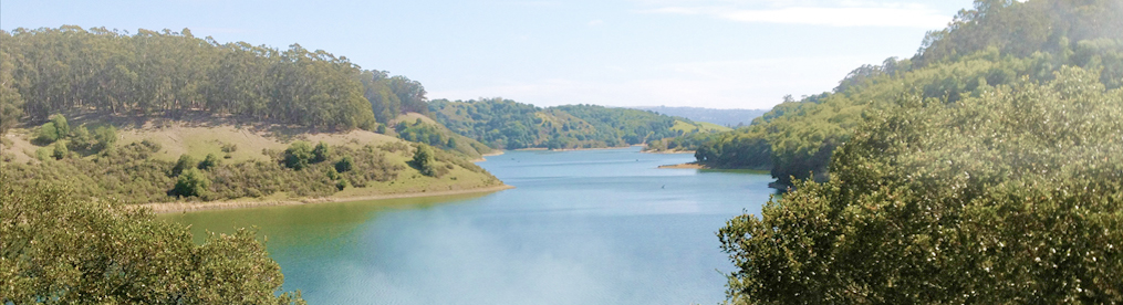
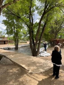
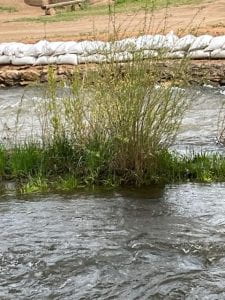
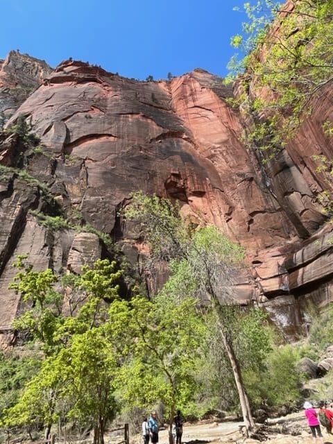
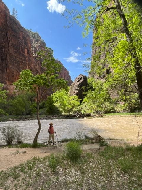
The city of Taos is encircled by the Red River, famed for its Red Willows , really a river weed with a red tint in it blossoms. The river flooded periodically, but seemed moderate depth that day.

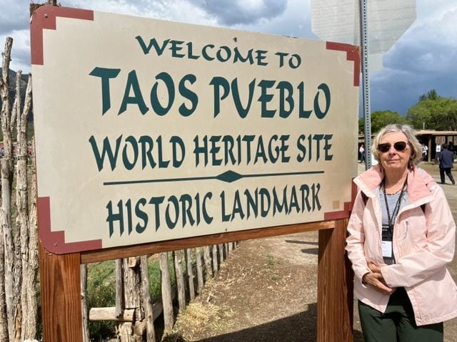
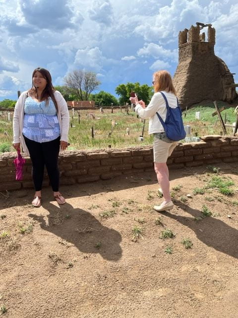
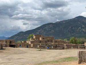
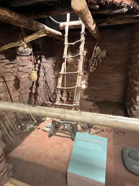
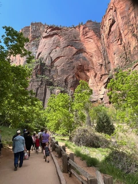
The Pueblo maintains the adobe fashion of rectangular, one or two story buildings fortified by berms and ditches against the overflow of the Red River.

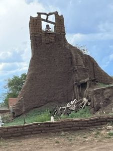
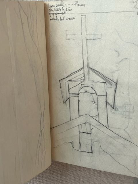
There are two churches standing in the Pueblo: one bombed out during the invasion of  U.S. troops claiming the territory. The Taos denizens thought the sanctuary of the church would protect them, but the army avoided the problem of violating the building by bombing it from the outside.


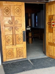
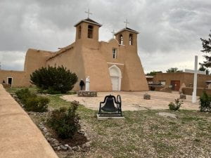
St. Francis Church replaced the stricken building with a splendid house of worship. We were asked not to photograph the interior.


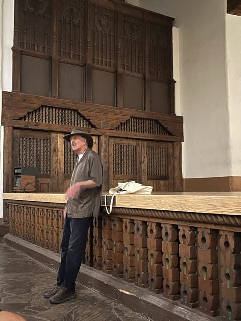
We were escorted around the pueblo by our gracious host, Ariana.   She  pointed  out the dire straits  of  some  residents  without self-consciousness. She made  us  feel  welcome.


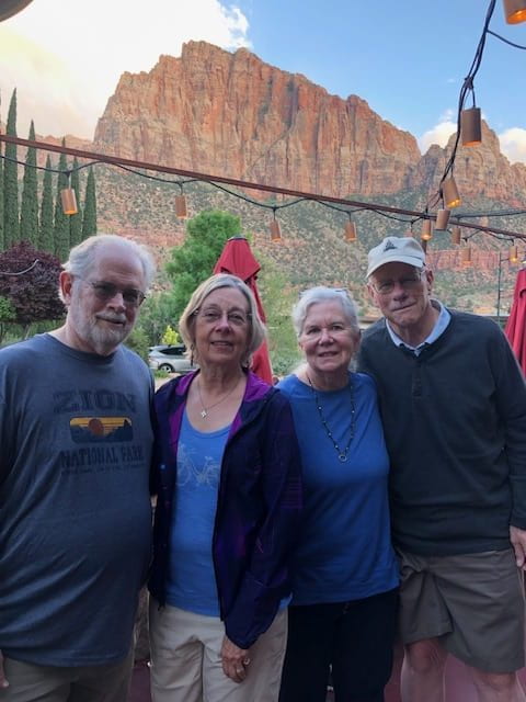
Road Scholar friends David Overcashier and Rebecca Ellis


The pueblo was a great place to buy powders and sauces to transform our anglo meals at home. The vendors had the best in jewelry, artifacts and spices.

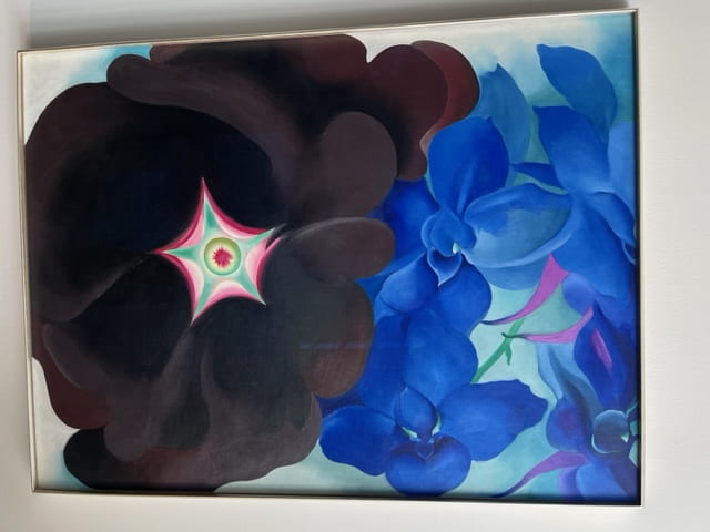
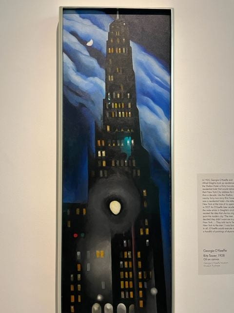
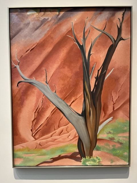
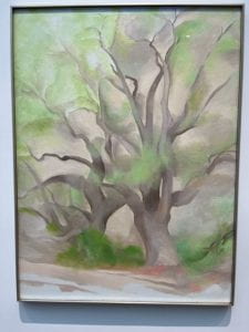
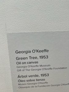
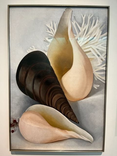
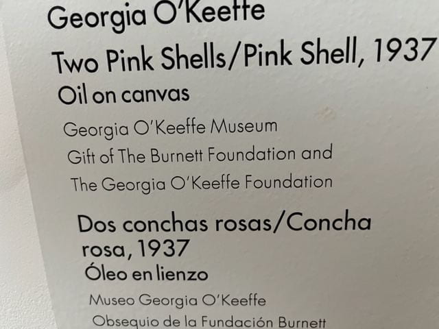
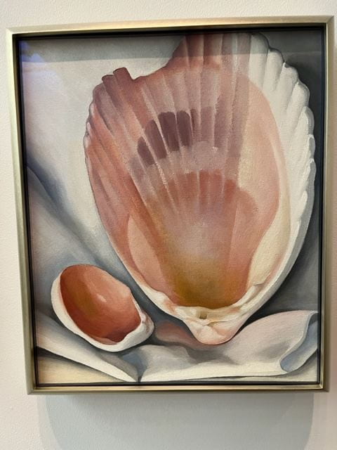
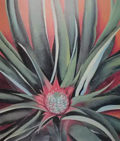
Which of these is a gorgeous watercolor by our friend Rebecca Ellis? Hint: one is by Georgia O’Keefe


Georgia O’Keefe

Jerry Rightman lectured at the Pecos Room, Hilton Hotel two consecutive days in Santa Fe.

On Day 1 he toured the life of Georgia O’Keefe,  first as a realist painter in 1908 till 1915 when she met Alfred Steglitz. Some of her early impressionism reflected the conventions of photography, which framed subjects like “Black Hollyhock” below.

Jerry Rightman


O’Keefe was influenced by impressionists who practiced synesthesia, the expression of one medium in another medium, such as the sound of bells ringing in the church belfry below.

She cohabited with Steglitz in New York during a period when critics sexualized her work, and he did not discourage that interpretation, as an art exhibitor in New York. They married in 1925. d

She attempted only a few streetscapes, one of which is portrayed in somber blue and black below. Note in Museum annotations, her struggle for acceptance among male artists in New York.

Many of her still life’s had a dream quality that made them memorable, such as


Some of the sharp photographic images appear during her years in Hawaii working under contract from Dole Pineapple.

Georgia O'Keeffe Pineapple Bud painting in a Dole Pineapple Juice advertisement, 1939. Georgia O'Keeffe: Visions of Hawaii. Photograph by Howard Schwartz.
Pineapple Bud Georgia O'Keeffe

It was a pleasure to hear Jerry give a clear-eyed commentary on O’Keefe before we visited the Museum on Thursday afternoon, so we were not distracted by critical reviews and the Museum’s protective curation of her paintings.  I’ve come to appreciate her many moods and styles by just viewing each painting as moment in time, rather than tracing some impressionistic, abstract, or photographic realism period of development.


Mesa Verde (2)

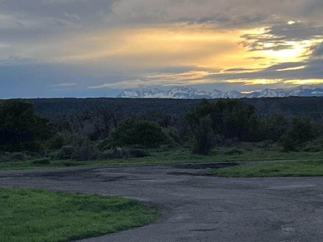
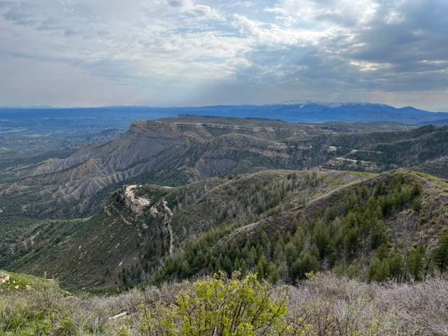
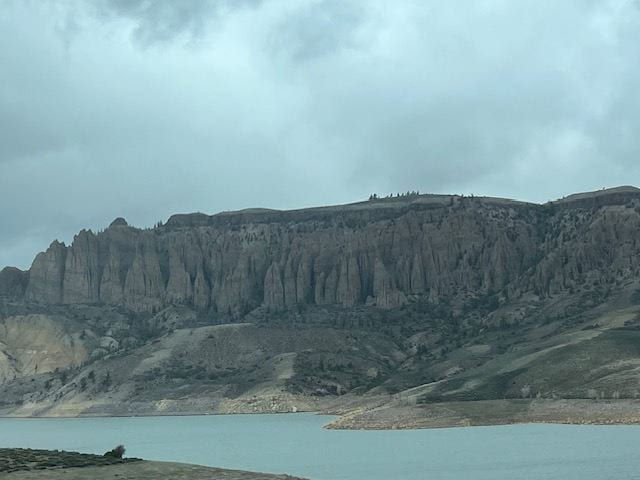
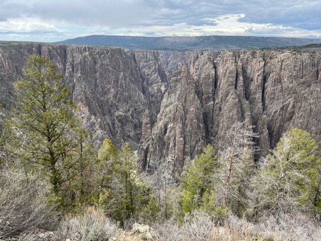
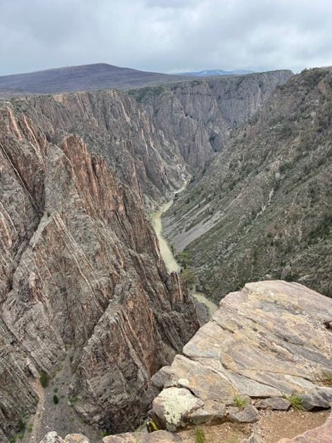
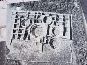
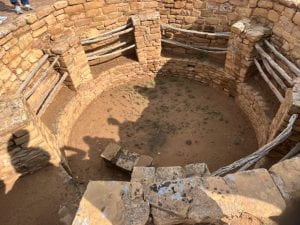
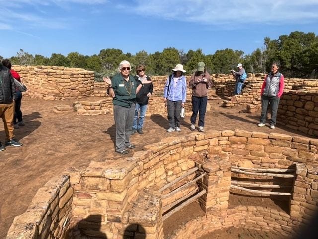
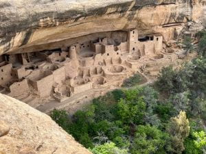
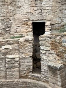
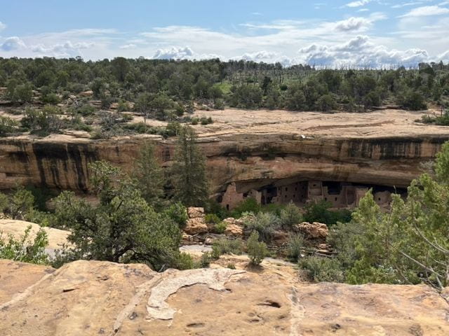
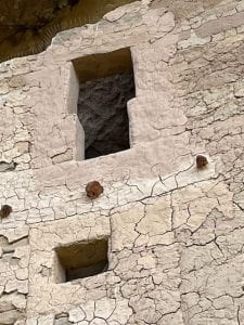
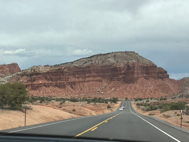
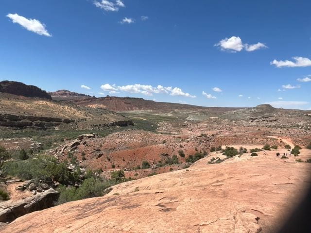
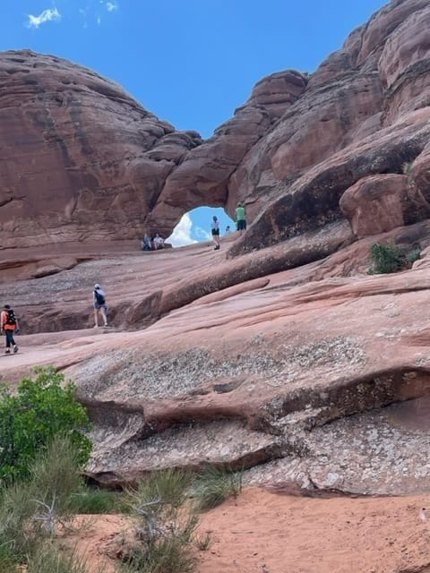
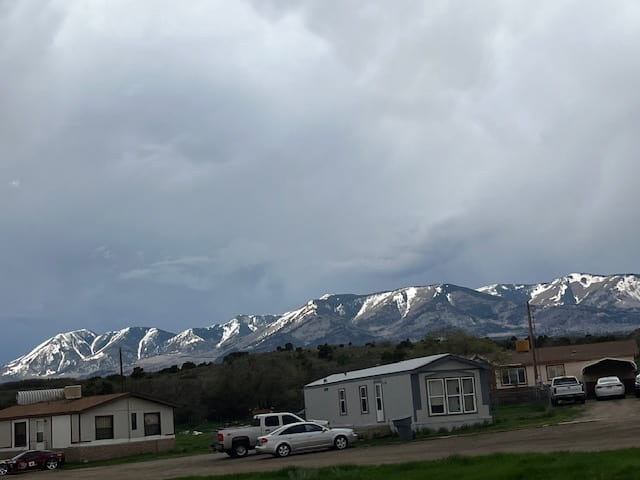
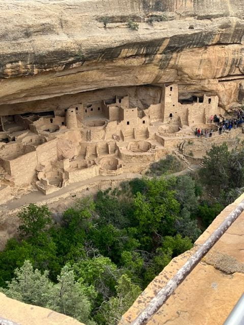
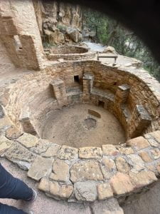
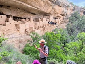
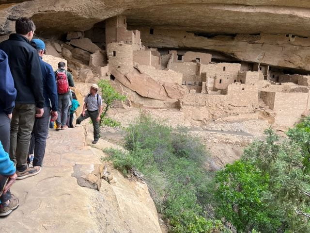
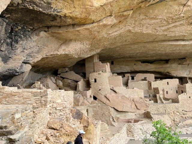
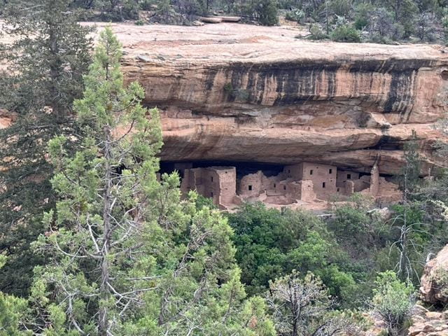
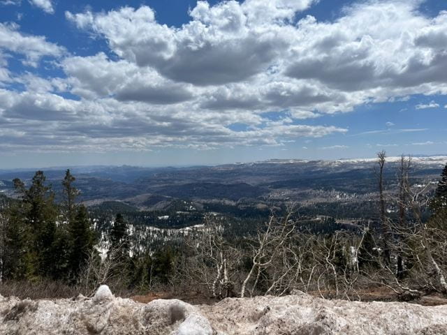
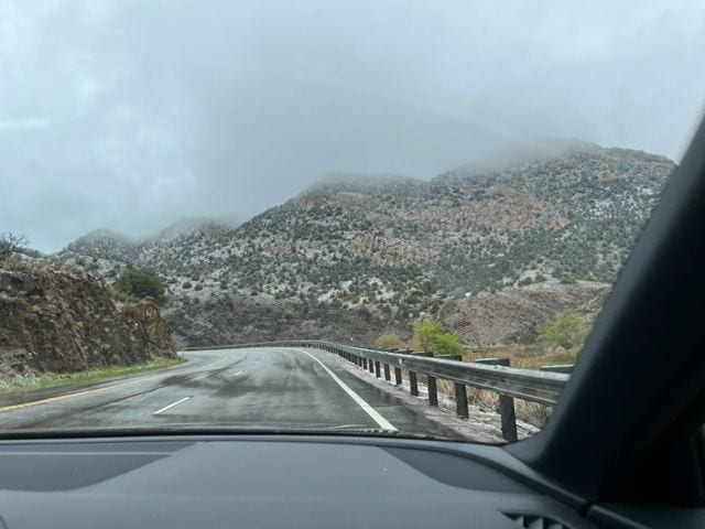
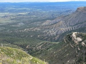
Mesa Verde is surrounded by boundary ranges that defined the territory of the Ancestral Pueblo People who lived in the cliff dwellings. On the east the San Juan Mountains and on the west, the Ute Mountains. They farmed the plateaus and carved out villages in the canyon alcoves. On Sunday we visited both the mountain overlooks and three of villages built from sandstone and mortar.

Coyote Village is defined by four kivas and twenty rooms in the overview photo below. In the description below the village is described as Far View House.  This village is at the highest point in the Park, Point Overlook, where our guide Gian brought us on Sunday.


Below Gian describes the customs observed in the kiva. Usually the spiritual practices lasted 7-14 days, requiring overnight stays in the kiva, while a fire smoldered in the center, filling the room with smoke.  The smoke was considered a purifying vapor in the room, even though it vented from the top.  The kiva pictured was connected to an adjoining kiva by a narrow passage, suggesting a common clan or cooperation between clans.


Gian noted the unique T-shaped door openings, with no clear purpose, unless to carry wide loads overhead.We visited the Cliff Palace a second time on this tour, getting another ranger’s perspective.

Across from the Palace is a single level dwelling near the top of the canyon called “Kokopelli lodge” by explorers of the canyon.  It is not clear how the two dwellings were connected, if at all.

The Arches (revised)

We ascended the plateaus called  “The Grand Staircase” on Wednesday, an awe-inspiring climb, but not reducible to photos. Probably I should say “Phone-camera” photos, because that is what I am using for the journey. There are imposing colorful canyon walls lifting you gradually into higher layers of the Colorado Plateau.

The wooden ladder raised toward the daylight is a model of an underground Anasazi dwelling, typical of early settlements in this area, prior to the cliff dwellings. The Anasazi are today called the Ancestral Pueblo People, which connects them with their descendants still living in pueblos today.  They also resided in the Mesa Verde area from 500 – 1300 CE, where they developed sophisticated clan-based communities, but on the surface and in the cliff dwellings.


In the meantime we visited The Arches in  Moab, while staying two nights at the luxurious Element, a Marriott hotel near the entrance to The Arches. On Thursday we drove to middle of the Park, where the trail to the Delicate Arch began. It was an intimidating mile and a half hike with a 450 rise, lots of sloping rock one narrow cliff-side trail at the end. Called “moderate,” it was a radical trail for senior citizens.  Fortunately the journey cooled down with refreshing breezes near the top.

As anyone who has been there will tell you, the Delicate Arch is worth the trip and hazard. We were completely gratified by our ambition and resolve, and rewarded ourselves with lunch at the top.


The hillside with the white icing is actually a reddish cliff area referred to as “fins,” slices of  heaved up rock that cluster in The Arches Park.

We finally revisited the the Windows area near the park entrance, a neighborhood we visited the last time we paused  at The Arches. There are three distinct “windows,” one visible from the parking lot, one a few steps beyond, and a third called the “Double Window.”  They are also hard to recapture with my lens.

This was our last stop before Mesa Verde, coming up on Friday, Saturday and Sunday.

Mesa Verde

Transition from the 80-degree sun of Moab, UT to the 60-degree overcast of Cortez, CO, the home of Mesa Verde.  We settled into our crawlspace at the Far View Lodge and dined over-looking the same horizon of snow-capped Rockies we observed on our trip south.  Below, Victoria enjoys the view in anticipation of a superb trout dinner. The braised beef was recommended by our waiter, and it proved up to the hype. The view, the food and the company made it a special evening.


The tour of the Cliff Palace on Saturday morning was an imaginative leap into a First Millenium society called the Ancestral Pueblo People. They transformed from a hunter-gatherer culture into an agrarian society around 750 CE.  How they came from the plains to the cliffs of Mesa Verde in 1200 has been a mystery, as was their slow departure around 1300. The largest motivator for migration was availability of water, and a few drought seasons could account for their migration, both arriving and departing.

The lower stories of the pueblo were housing for clans that expanded with every generation. They revolved around a circular room, the kiva, a room for public events, whether community councils or celebrations of life.


The upper stories were for storage, including grain, tools and weapons. It is believed this cliff dwelling housed at least one hundred people of all ages, divided into eight clans.


We visited the Spruce Tree House, the best-preserved of the cliff dwellings, but the access to the building was under construction, so we had to be content with distant shots of the wall.


We ended the day back at the Far View Lounge, sampling raspberry pistachio salad (Victoria) and a Cider Margherita (me), while exploiting the better Wi-Fi in the lounge and finishing this update of our Southwest Journey.

Marvelous Bryce Canyon

After a leisurely morning driving through the east side of Zion Park, we turned north and arrived at Bryce Canyon Lodge around 1:30 on May 15,  a little after the McColls, who had adjoining room to ours. We had two nights’ reservations at the Lodge with ample room just a couple hundred yards from the Canyon rim.

Great views from the rim during the afternoon and evening, including the configuration of Thor’s Hammer, Queen Victoria, and other fancied images of the Amphitheater.  We walked the rim before dinner and ate at the Lodge, a bit pricey, but the food was average.


Victoria and I were involuntarily awake at 4 a.m.the next morning, but we had planned to view the sunrise from, appropriately, Sunrise Point. We were about a half hour early to arrive at the viewing platform, but we had the best position and plenty of pre-sunrise photos as follows.


So  sunrise  was  not overrated.  We  were thrilled to witness the glory of a day that actually started cloudy, but turned into a bright and warm Tuesday, which follows . . .

Zion Day 3

Every day at Umder-the-Eaves began with breakfast at Oscars’, only twenty yards down the street.  The guest house took a small per diem charge to get us a hefty, Mexican breakfast. The mornings were sunny, and we ate on the open-air patio.

The walls of Navajo sandstone and red Kayenta loomed behind all the buildings lining Zion Park Boulevard. You felt enclosed by the canyon before you even reached the Park Entrance.


Ranger Jason gave us geologic background, both on a Saturday talk and on a Sunday walking tour of the Par’us Trail. The long evolution of the Canyon was captured in his acronym:


D– Deposit

U–Upheaval (plates)

D–Downward cutting (river erosion)

E–Erosion (rain, wind, fluctuating temps)

He gives credit to his Southern California upbringing for this succinct acronym.

Thanks to Jason for animated stories and caution to get us out of a thunderstorm. We got off the trail with good memories.

The end of the day was perfect for life at Zion. We ate upscale at “The Spotted Dog,” which probably has the best backdrop in Utah– a looming canyon wall with all the colors of a DUDE landscape: creamy white Navajo sandstone to the rust-iron Kayenta layer to the darker, Moenave formation to the Chinle basement. We ate on the patio in the early evening and felt the shared awe of a sacred ground.  Good food, good friends, awe-inspiring  Zion.

Beautiful, beautiful Zion.

On Spotted Dog patio

Zion Day 2

Garden Cottage #4

Our second day at Zion began with breakfast with the McColls at Oscar’s Cafe, a Mexican-style restaurant just a hundred yards down the street from Under the Eaves.


Our breakfasts were paid in advance with a modest fee paid to our hosts. Conveniently Oscar’s was across the street from our Springdale bus, a free shuttle that took us to the Park’s entrance. From the Visitor’s Center we picked up the Park Shuttle, which took us up the spine of Zion on a scenic tour only accessed with the shuttle.

Zion was pretty busy in May. The outbound shuttle was full and families and young tourists were everywhere without quite crowding you off the trail. We could only imagine what the high tourist season was like.

The shuttle follows the Virgin River up the middle of the Canyon on a narrow blacktop route. There are eight stops, one of which is the Zion Lodge, a small two-story cabin-style hotel for early birds who reserve before most of us are thinking of summer.

We took the shuttle to the last stop, the Temple of Sinawava, and hiked about a mile up the river and bank. Plenty of people on the trail already about 11 a.m. The squirrels were begging for lunch, alongside signs that forbid feeding them. You could hear birds twittering up in the foliage on the canyon walls, but they were mostly invisible. Tony did spot an eagle near one of the shuttle stops, but we could not authenticate with a park ranger.

Victoria at a bend in the Virgin Rive


We ate lunch at a picnic table at the Temple of Sinawava, courtesy of provisions brought in by Susan, who conscientiously carried our trash back to the  Zion Visitor’s  Center.

At the Center we signed up for a ranger-led hike on Sunday and attended a lecture on the human history of Zion, from the settling of the Paiute tribes to the 100th anniversary of the Park in 2019.  The southwestern territory was by passed by the Spanish as impassable for well into the eighteenth century, but they created the Spanish Trail in search of the “Seven Cities of Cibola” (gold). Eventually the LDS (Morman) settlers found the territory as suitable for a refuge from persecution.  They farmed the land around the Park and gave it the name “Zion” with reference to the secure city of God.

Our ranger-historian Jason mentioned several other noteworthy explorers who mapped the Canyon, but I can not recall them today. My apologies to the very fluent and dramatic Jason. He will be our tour leader on Day 3.


Crossing the Divide

On Tuesday  (May 8) we started across the Central Plains en route to Zion National Park.  The Plains are not tourist attractions, dotted by grain elevators, oil rigs and wind turbines, but the majesty and profusion of the turbines deserves mention. They are like immense alien visitors, turning slowly with a fairly stiff wind that followed us the last two days.

They are so imposing, rising up from the floor of earth into the atmosphere, apparently communicating with their home planet. They are an intriguing contrast with the rural conservative industry of agriculture. They speak to the alternative to fossil fuel consumption with a profusion of giant turbines, hundreds of them along Route 70 on the Central Plains.

We landed in West Pueblo, Colorado Wednesday night, listening to incessant thunder and falling rain. This was going to be our slow tour day to catch the eastern Rockies and river valleys between here and Grand Junction. By tomorrow afternoon we hope to be at Zion, beautiful, beautiful Zion. Yes it was named by Mormons who marveled at its beauty.

Thursday the Rockies were on the horizon and pretty soon the snow caps and the wind. The temperatures sank as we climbed the mountains, and we reached 11,300 feet and thirty-three degrees by noon. That was the Continental Divide, so we started to lose elevation and gain degrees in the afternoon.

For our leisurely travel-day we headed for Black Canyon National Park just west of Gunnison, a university town with an actual Visitors’  Center, where we stopped to eat leftovers and a Starbucks sandwich for lunch.


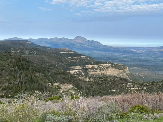
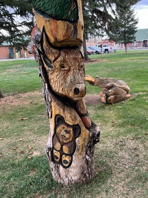
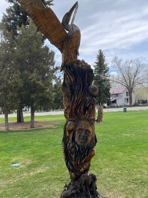
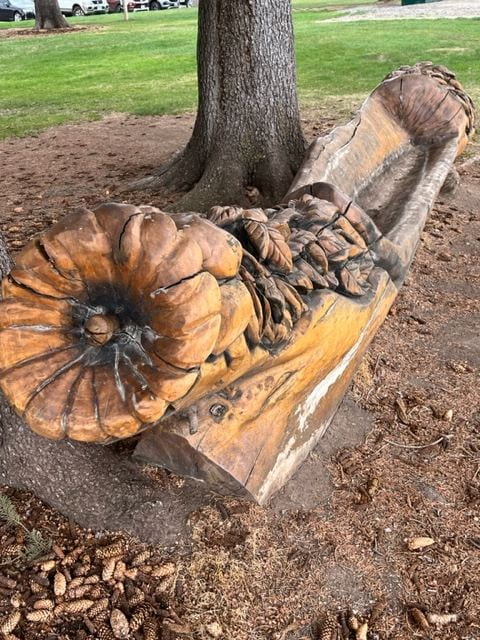
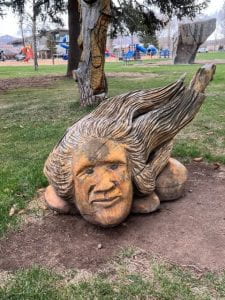
Behind the Visitors’ Center was an unusual playground with carved wooden images like totem poles.  They were set-up like playground furniture, but they were striking works of arts from human faces to cow faces on a pole to a corn cob boat/ sofa.  This town was the gateway to the Black Canyon National Park just to the west.


Below you see fissures inside and outside the Park. They show the variable erosion from snow melt and water run-off into the Canyon..


The Gunnison River cuts through and into the Canyon. It winds far below the surface of the Canyon. You can’t see it except at ideal angles looking upriver, and it looks like it’s flowing uphill as it foams over the rocks in the the river bed. We spent an hour in the Park stopping at special viewpoints, sometimes walking to the edge where there were safety railings.


Black Canyon National Park has great views and hiking and camping.  A great  foretaste for  Zion  and  Bryce  this  weekend.


Last Day in the Smokies: the Walker Sisters’ Place

The Walker Sisters’ Place was the fourth of “6 Short Hikes” recommended on a blog by Vicky Reddish on the Great Smoky Mountains National Park Website. Before Friday we had taken the Laurel Falls Trail, the Clingman Dome Trail, and the Grotto Falls Trails, all scenic and within a 2-3 mile roundtrip.

The Walker Sisters Place hike offered a creek alongside; a school house and cemetery; and a family tradition of almost a hundred years.  The Little Brier Gap Trail was narrow and criss-crossed with protruding roots, arriving at a schoolhouse at least a mile from the Park picnic area and a mile further to the Walker Sisters Place.

Below the interior and exterior of the school house is pictured, along with a longer shot from the cemetery  and a class picture of 1908.  The cemetery features a number of Walkers.  John and Margaret Walker had eleven children, four boys who made their fortune somewhere else and seven daughters, of which only one married.

The other six remained in the home until the 1960’s. Nancy passed away in the 1930’s and the other sisters stayed while the National Park was built around them. The Park land was acquired in the 1930’s, and the sisters benefited at first. They sold souvenirs and told stories that made them a Park attraction. In their older years, the attention became exhausting, and they asked for privacy. When the last sister died in the 1960’s, the land was deeded to the National Park service. Two views of the house are displayed below. You can climb a ladder to the second floor, but there’s nothing but a bare floor and a single window to see.

Plenty more to hike and see on a return visit to the Great Smoky Mountains National Park. There’ s Rainbow Falls, the Alum Cave Bluffs, the Hen Wallow Falls and the Blue Ridge Parkway. Everywhere you drive there is a mountain vista and a turn-off to park and take it in.  It leaves you with the sense of awe you know all Creation deserves. Here you can’t miss it.

Several days after returning to Chesterfield we got another taste of that quiet awe, when a fawn came to drink at our bird bath, and then feasted on our flower bed. Most of the flowers were past, but they left enough residue to appeal to a deer. The fawn lingered at least fifteen minutes, reassuring us that our home was her home as well.  It still shoots me full of wonder to get that close to the wild.